Grade II Listed·Documented since the 1780s·Chorlton, Cheshire
Chorlton Hall
A house remodelled and substantially enlarged across the 19th century, standing at the edge of the Cheshire–Wales border.
Scroll to explore
Behind a pebbledashed front and a slate roof stands a house that has been rebuilt as often as it has changed hands.
Documented ownership begins with George Mainwaring, a former minister recorded in a surviving deed as the owner who sold the estate to the Bennion family around 1784; the widely repeated 1664 date for the house's core is unverified, and may actually belong to the stable block. The Cluttons bought the estate in 1814 and roughly doubled the house in size as they made it their family seat.
Chorlton Hall has passed by purchase, by marriage, and — more often than either — by the quiet failure of an heir: from a former minister known only through a single surviving deed, to a family whose fuller record survives in the 1780s land tax rolls, to the Cluttons who rebuilt it, to a Cunard chairman who bought it outright in 1923. What follows draws on primary archival research commissioned for recent work on the house, which corrects an older, widely repeated story about who actually built it.
Descent of the House
Two and a half centuries of ownership
An older account had the Clutton family building the house in 1664 and holding it ever since. Primary research in the Cheshire Archives tells a different story — one confused for years with the neighbouring Chorlton Old Hall.
Select a period on the timeline — width shows how long each owner actually held the house. The record is genuinely incomplete in places, marked below where that's the case.
Before the record Mainwaring Bennion Clutton Crump Bates Gap in the record Present day
1
Undated
No documented owner
1 / 10
The House
A double pile, built twice over
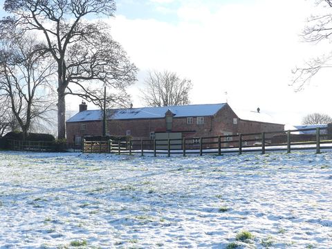
The Historic England listing gives the core of the house a construction date of 1664, but documented ownership only reaches back to the 1780s, and recent archival research suggests the 1664 figure may not belong to the house at all — see below. What's certain is the building campaign of the nineteenth century: the house was modernised around 1810 and then substantially enlarged around 1840, enough work, decades apart, that it reads as two structures grown together — a front pile holding the older core, and a rear pile in sandstone added later, joined by a kitchen wing behind.
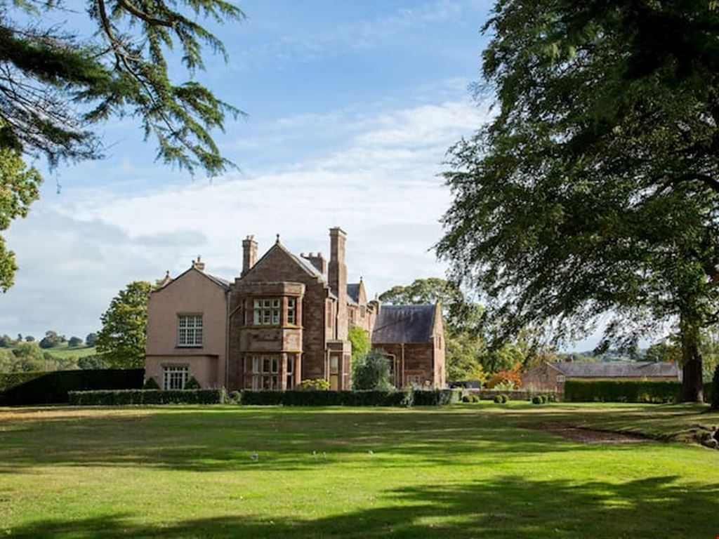
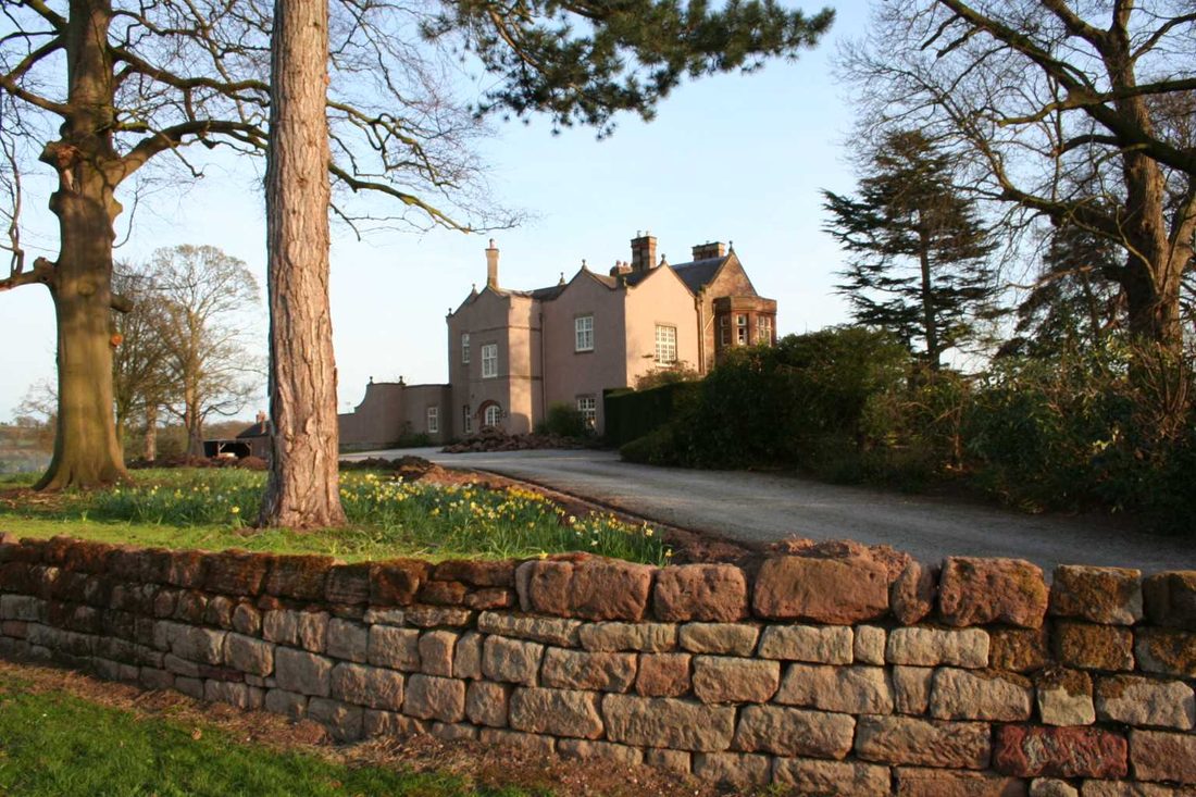
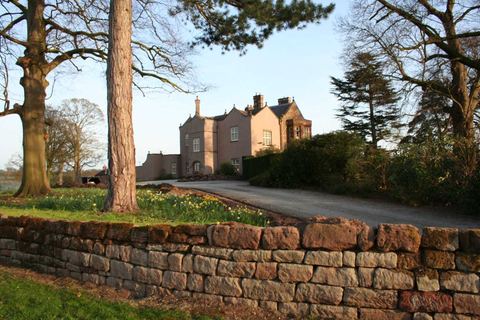
The entrance front, photographed today
Two houses grown together under one roofline.
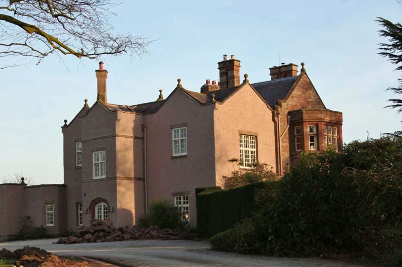
The west elevation shows that double-pile form most clearly: a plain, pebbledashed front pile against a taller, steeper-gabled sandstone rear pile added during the circa-1840 enlargement. On the garden front, a two-storey canted bay with metal casements looks out over the lawn.
The garden front, across the lawn
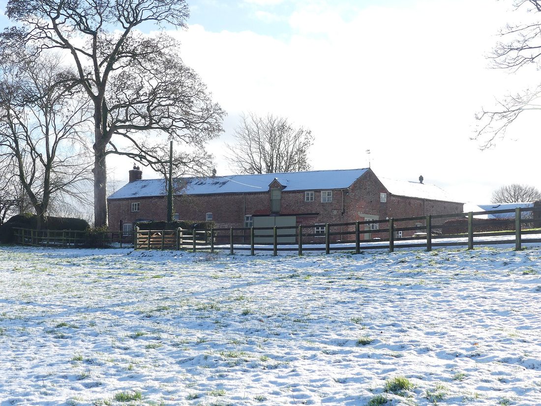
The stable block and two cottages, about 30 metres east of the house, share the same Grade II designation and were built between 1814 and 1837 — not, as the house's core might suggest, in the seventeenth century. Their door surround carries an inscribed date of 1661, "in the lifetime of George Manwaring" — a detail that may itself be the root of the old, incorrect story that the Cluttons built Chorlton Hall in the 1660s.
The stable block, in winterArchitectural drawings & annotated elevations
For anyone who wants the full detail: annotated line drawings of the entrance and garden fronts, redrawn from the description held in the National Heritage List for England, plus a simplified plan showing how the front pile, rear pile and side wings fit together. Elevation by elevation: on the north front, a section of wall extending east of the entrance is a surviving fragment of a former side extension, since demolished. The south elevation, largely Victorian, carries a two-storey "kitchen wing" with its own entrance, and a chimney stack with three flues and chamfered bases. The east elevation has seen the most change of any side of the house — a service and outbuilding range "constructed on an ad hoc basis," much of it now consented for replacement. Inside, the entrance hall is dominated by a later staircase with barley-twist banisters; a regency-style door leads through to the living room, and a separate, plainer staircase to the south-east served the house's staff. The drawing room holds most of the surviving decorative work — a moulded fireplace surround, and bay-window shutters concealing the remains of sash-window pulleys, now largely hidden behind later casements. The base of a swing door still marks, physically, where the family's rooms ended and the service side of the house began.
Entrance front, schematic — after the description held in the National Heritage List for England, entry 1330593
Explore the front
Hover or tap a labelled point on the drawing above for the fuller description from the listing.
Garden front, schematic — sandstone rear pile added in the later building campaigns
Explore the garden front
Hover or tap a labelled point for detail on the sandstone rear pile.
The "double pile" — front pile plus later rear pile, joined by the kitchen cross wing
"Double pile" is the term for a house two rooms deep under a single roofline — here, the older front pile facing the lane, its own date uncertain, and a full second range added behind it in sandstone during the circa-1840 enlargement, joined by a kitchen wing running crosswise between them.
The Footprint Through Time
How the plan of the house has changed
Documentary map regression carried out for a recent Heritage Impact Assessment traces the Hall's footprint in detail across seven surveys, from an 1805 estate plan through to the 1970s. 1805 is not an arbitrary starting point — it is the true edge of the surviving record; the tab below explains why nothing earlier is known to survive. From there, the house grows steadily through the nineteenth century, its service buildings reach their fullest extent by the 1970s, and several of those later additions — a games room, a garage extension, a connecting block — are gone by today, removed at some point before the current owners acquired the property.
These are original schematic redrawings informed by that documentary research, not reproductions of the source maps themselves. The final frame is the real footprint from Historic England's official record.
Before 1805 — no plan of the house is known to survive, and this is the genuine edge of the documentary record rather than a gap in this website's research. The Heritage Impact Assessment's own archival search of Cheshire Archives found nothing earlier: surviving land tax records begin only in 1784, and Lichfields describes the 1805 estate plan as "the earliest map depiction" identified for the site.
Cheshire itself had been surveyed at county scale for more than two centuries before that: Christopher Saxton's Cestria (1577) — the first printed map of the county — John Speed's map (1610), and Peter Burdett's much more detailed survey (1777). Saxton's map does mark villages and hamlets, typically as a small building symbol, though not consistently by name; Burdett's survey, at a far finer scale, was specifically known for recording individual gentlemen's seats. The Burdett sheet covering Malpas has since been checked directly against this site: Chorlton is not among the names legible around the town on that copy. The dense engraved script of the period makes total certainty difficult, so this is a careful reading rather than a definitive one — but it's a real check, not an open question.
A named "Chorlton Hall" does exist earlier than any of this, however — just not as a plan or a map mark. The deed of the Chorlton Hall Estate records George Mainwaring, a former minister, as the owner who sold to the Bennion family, and the deed already uses the name "Chorlton Hall" for the property at the time of that sale — meaning the estate carried this name before the Bennions' documented ownership begins in 1784. Lichfields' own report is inconsistent about exactly when: one passage gives the sale date as 1684, another implies the 1780s. Since the Bennions only appear in the surviving land tax records from 1784, 1684 looks like a typo for 1784 in the original document, though that hasn't been independently confirmed. Either way, a deed recording a name is a different kind of evidence from a map recording a building — the estate can have carried the name "Chorlton Hall" in law well before any surveyor thought it worth drawing.
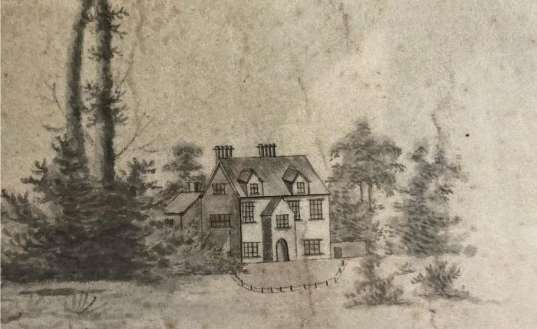
1805 — the earliest clear depiction of the house, commissioned by owner John Bennion. A substantial stable cluster stands to the west, later cleared for a tree-lined approach.
1837 — after Thomas Clutton's purchase, the estate is reoriented: entrance from the west, a new stable block to the east, a formal garden replacing the old west stables.
1874 — the scale of expansion since 1837 is dramatic: a full second pile added in sandstone, and the east outbuildings now enclose a courtyard.
1897–1913 — the courtyard breaks up into a straighter run of buildings, including a structure resembling today's garage. A covered walkway appears by 1913.
1972/73 — the fullest the estate ever gets: a timber games room added southeast, a shrunken glasshouse, and the northeast extension still standing. All of this is gone by today.
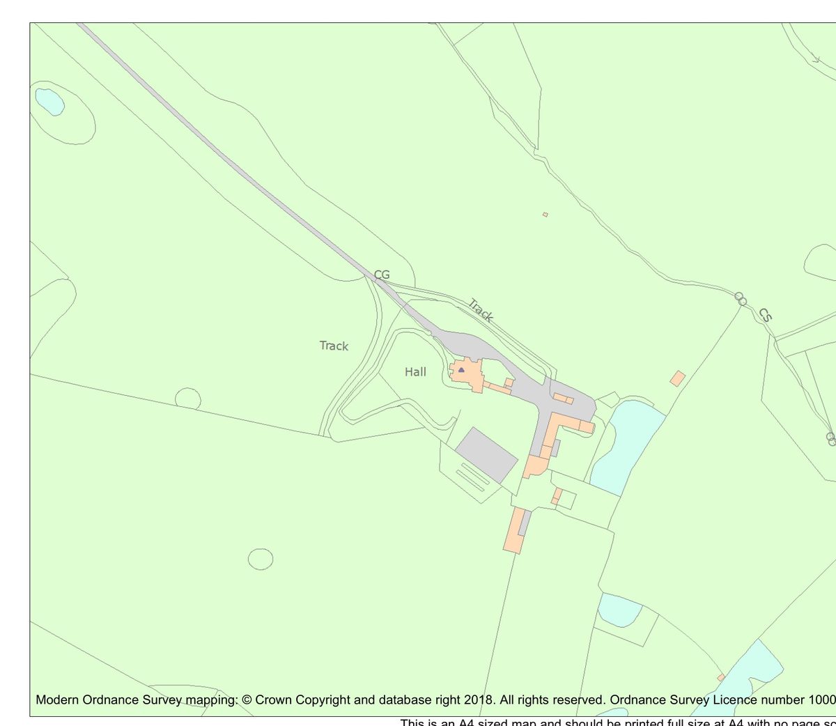
Present day — Ordnance Survey mapping via Historic England's official listing record, List Entry 1330593 (Crown copyright). Consented 2022 works will further alter the east side of the plan.
Through the Centuries
The house in its own time
Where the map regression above traces the house's changing plan, these five images trace its changing face — spanning 165 years, from a vignette on an 1805 estate plan to a sale photograph taken the year the Bates family left. Together they show the house growing outward from a compact Georgian core, reaching its fullest Victorian extent, then photographed at the moment it changed hands for the last time before the present day.
1805
A vignette from "A Map of an Estate in Chorlton belonging to John Bennion Esq." — the earliest known depiction of the house. Two chimneys, a fenced garden, stables to the west still in place. The rear pile has not yet been built.
c.1850
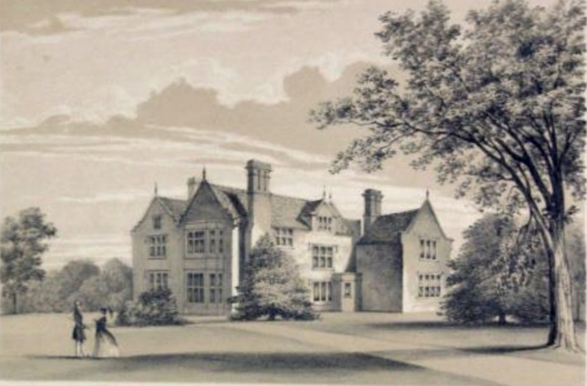
The Twycross engraving, published in The Mansions of England and Wales: Cheshire (London: Stovin & Bartlett, 1850). Captioned "Chorlton Hall, the seat of Thomas Chorlton Clutton Esq." — the sandstone rear pile now complete, though the projecting north-east bay has not yet appeared. The figures on the lawn suggest the formal western garden already in place after the estate's reorientation under Clutton ownership.
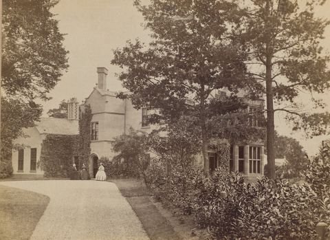
c.1855
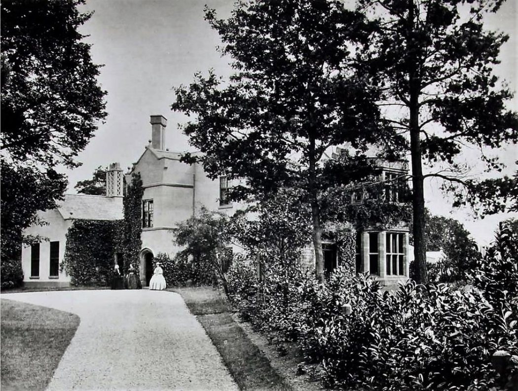
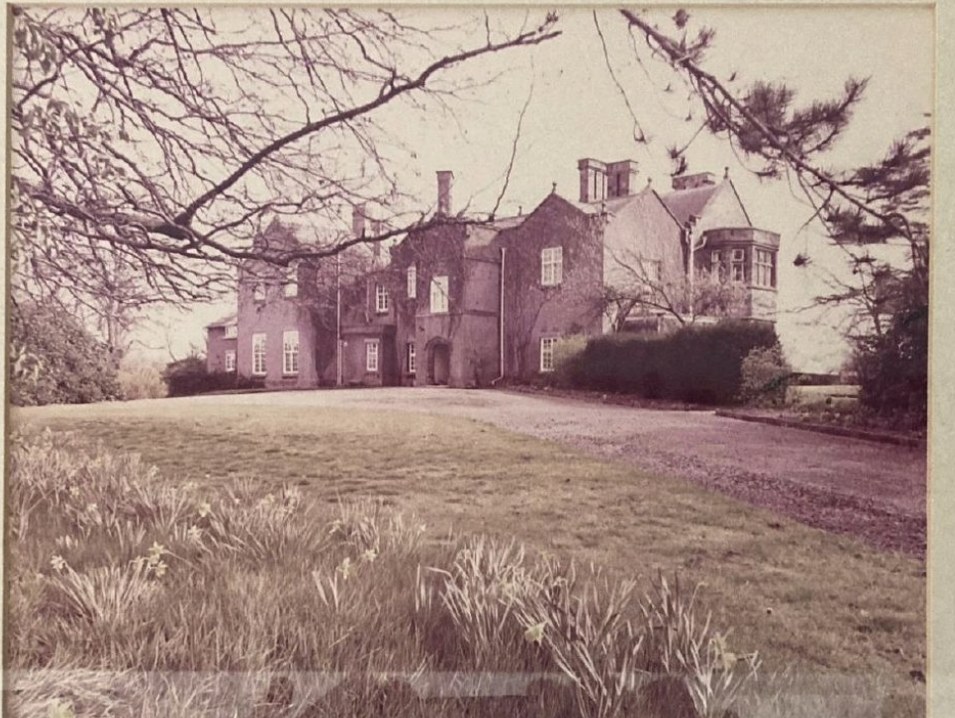
The earliest known photograph of the house. The two-storey bay window confirms this post-dates the 1840s enlargement. The east extension is still single-storey at this point — it would gain another floor in the following decades. Two figures stand at the entrance.
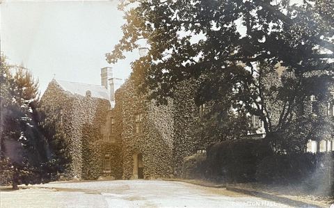
Early 20th century
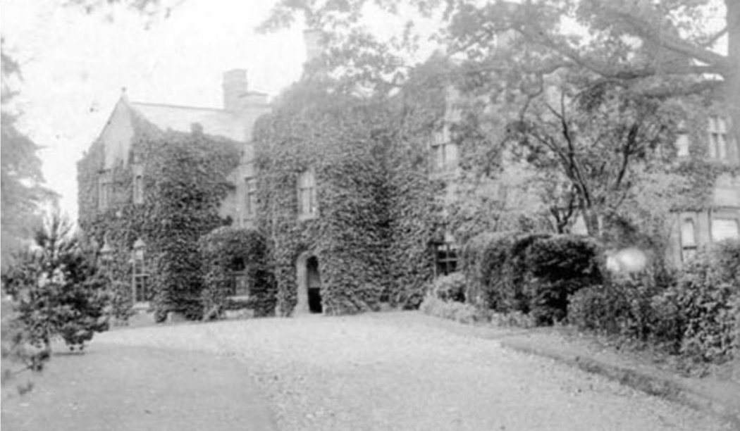
The entrance front entirely ivy-clad. The east extension has now been raised to two storeys, with ball finials to the gable matching the main house. This is the house as the Crump family held it — largely unoccupied, the ivy growing unchecked through the long absentee years before the 1923 sale.
1970
The sale photograph from Denton Clark & Co. — the image used when the house was sold following the death of Aline Bates, closing the longest single ownership in the house's documented history. Daffodils in the foreground, the ivy now gone, the east extensions at their most extensive. Everything visible to the left of the main block would later be demolished.
Setting
Parkland with a longer memory
The estate carries an ornamental garden and parkland setting, but its most telling feature is older than the house itself.
The park wall, in spring
Across the parkland, the ground still rises and falls in long, regular waves — the fossilised remains of open-field ploughing from the medieval period, centuries before Chorlton Hall was built. Ox-drawn ploughs, always turning the soil the same direction along a strip, built up ridges over generations of use. The pattern survives only because the land was later turned to pasture and left undisturbed.
Mature planting throughout the parkland marks successive generations of owners who treated the grounds as seriously as the house — an inheritance of its own, laid down in slower time than any single tenure of the estate.
Ridge and furrow, in cross-section
Cross-section, ridge and furrow — medieval strip ploughing, preserved under later pasture
On the Cheshire–Wales Border
Chorlton Hall stands in the small parish of Chorlton, roughly a mile and a half northwest of Malpas, in the far south of Cheshire — closer to the Welsh border at Wrexham than to Chester, the county town.
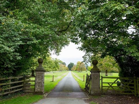
The gates onto the drive
National Grid Reference SJ 46595 48253 — Cheshire West and Chester unitary authority, Church of England parish of Malpas St Oswald, Diocese of Chester.
Identity
Seven centuries of spelling
Long before there was a hall to name, there was a settlement called Chorlton — and the written record of its name shifts, generation by generation, as scribes reached for their own way of putting the same sound on paper. Drag the marker through the record.
Cherleton1283
128316481819
The name derives from Old English ceorl (a free peasant farmer) and tūn (a farmstead or settlement) — literally, the peasants' farm. In earlier centuries it is recorded as one of several Chorltons in the parish of Malpas, distinguished locally as "Chorleton Malpas" or "Chorleton iuxta Cudynton" — Chorlton next to Cuddington.
Not to Be Confused With
Searches for "Chorlton Hall" turn up a second, unrelated house of the same name — a lost manor in Chorlton-on-Medlock, now part of central Manchester. The two share nothing beyond a name inherited from the same Old English word.
County
Cheshire
Built
Core date uncertain (often cited as 1664); enlarged c.1840
Status
Standing — Grade II listed, private residence
Owning family
Mainwaring, then Bennion, then Clutton, then Crump, then Bates
Setting
Rural parkland, near Malpas
Style
Pebbledashed front, sandstone rear pile
County
Lancashire (historic) / Greater Manchester
Built
Medieval origin; sold for manor in 1590
Status
Demolished — lost to Manchester's urban expansion
Owning family
Trafford, then Sorocold, then Aytoun
Setting
Chorlton-on-Medlock, later built over with streets and warehouses
Fate
Sold for development in 1775; site absorbed into central Manchester by the 1790s
Photographs
The house, in seven frames
A mix of the present day and the archive: recent photographs of the Hall, its stables and grounds, alongside two older photographs from the house's own collection. Click any photograph to view it larger.
Entrance front
Garden front
The gates
The grounds
Stable block
Archive
Archive
Recent photographs and archive images from the house's own collection.
The Record
Official designation
Chorlton Hall is protected under the Planning (Listed Buildings and Conservation Areas) Act 1990 — and it isn't the only designated heritage asset on the site. The stable range and cottages roughly 30 metres to its south-east carry their own, separate Grade II listing. Both entries below are drawn from the National Heritage List for England.
Heritage Category
Listed Building
Grade
II
List Entry Number
1330593
Date First Listed
22 October 1952
Statutory Address
Chorlton Hall, Chorlton Lane
National Grid Reference
SJ 46595 48253
Parish
Chorlton
District
Cheshire West and Chester
Principal Sources
Lichfields — Chorlton Hall: Heritage Impact Assessment, prepared for a householder planning and listed building consent application (November 2022)
Ormerod, G. — The History of the County Palatine and City of Chester, Vol. 1 (1882)
Twycross, E. — The Mansions of England and Wales in the County Palatine of Chester, Vol. 2 (1847–50)
Cheshire Archives — Land Tax Assessments for Chorlton (1784–1832) and Deeds of Chorlton Hall Estate, Malpas
Survey of English Place-Names — Cheshire (Malpas parish entries)
Stable Range and 2 Cottages to South East of Chorlton Hall, Chorlton Lane
Parish
Chorlton
District
Cheshire West and Chester
Built between 1814 and 1837 to serve the main house — later than the 1661 datestone on their own door surround suggests (see The House, above, for the story of that inscription and how it likely migrated here). Brick with slate roofs, they carry modest aesthetic value in their own right and illustrate a time when horses were an estate's main means of transport; their strongest heritage value comes from their group relationship with Chorlton Hall itself.
Assessed against Historic England's four categories of heritage value, set out in a 2022 Heritage Impact Assessment prepared to support work on the house.
Evidential
The house's history can't be fully reconstructed from documents alone — ownership before George Mainwaring is essentially undocumented, and the eastern service wing has been altered so many times its full sequence is hard to trace. What survives in the fabric of the building has real potential to answer questions the paper record can't.
Historic
Chorlton Hall isn't associated with any nationally significant figures — its interest lies instead in illustrating nearly three centuries of changing taste and social hierarchy, most visibly in the 1814–1863 period when the Cluttons rebuilt it as a family seat, complete with a new service wing and staircase reflecting a clearer separation between family and staff.
Aesthetic
No identified architect worked on the house, and no single room is of the highest design quality — but the cumulative effect of genuine Victorian interiors sitting alongside earlier surviving features gives it real character as a multi-layered, evolved building, set in open countryside.
Communal
As a private house, its value to the wider community is limited — though as the centre of a historic estate, it still carries some local significance for the immediate area.
Chorlton Hall remains a private residence. This page exists to record its architectural and family history for researchers, genealogists and anyone drawn to the house from the road — it is not an invitation to visit, and the house is not open to the public.